Col de Pierre Carrée
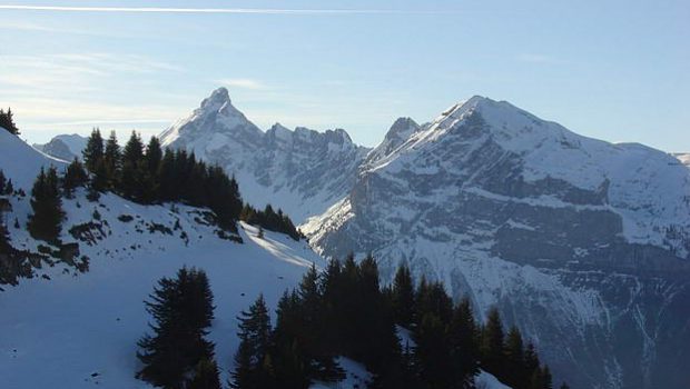
From the Col de Pierre Carrée, which is the northern part of Flaine ski resort, it is possible to take a pedestrian route that leads among the pines to reach an ideal point of view on the valley of Cluses and the ski resort of Carroz d ’Araches.
On the other side is the panorama of the large ski resort of Flaine, and notably Belvédère d’Aujon.
The route is easy, well signposted, is a real initiation without risk to snowshoeing as it lasts only one hour.
- Difficulty: Very Easy
- Altitude: 1,844 m
- Ascent: 0 hour 20 min
- Descent: 0 hour 20 min
- Elevation Gain: 90 meters
- Round-trip: 2.3 km
- Map: IGN 3530 ET
Getting There
The departure is to the right of the road, before arriving at Flaine, at the Col de Pierre Carrée, in front of the building of the Chasseurs alpins.
GPS Coordinates (WGS 84) of the Starting Point : 46.011823, 6.678243
Ascent
Take the leftmost trail signposted “Pedestrians” and follow it to reach a large building.
Bypass it by the left and head towards the highest point surmounted by a high voltage pylon from where you can see a superb viewpoint on the valley as well as Flaine.
Descent
Continue to the left and to get back to the trail.
Photos of the Col de Pierre Carrée
Route
Download the route (KML) Download the route (GPX)
This post is also available in Français


