Tête du Danay
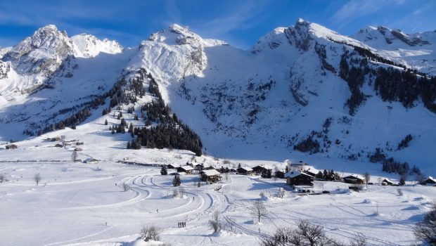
Tête du Danay, located in the heart of La Clusaz, is a magnificent viewpoint over the Aravis Range and the Bornes Massif dominating Grand Bornand village.
The itinerary is ideal for a discovery of winter hiking in snowshoes since the elevation gain is small and the path void of any difficulty. Only a relatively good physical condition is necessary to admire the superb overlook offered to the hiker.
- Difficulty: Easy
- Altitude: 1,731 m
- Ascent: 1 hour 10 min
- Descent: 0 hour 50 min
- Elevation Gain: 340 meters
- Round-trip: 5.3 km
- Map: IGN 3430 ET
Getting There
At La Clusaz, take the direction of Les Confins and park as close as possible to the chapel.
GPS Coordinates (WGS 84) of the Starting Point: 45.919987, 6.478973
Ascent
The start is on the left of the cross-country skiing chalet, near the chapel. Take the signposted pedestrian trail going to the right and upright towards the forest.
After a small steep climb, you reach the cross-country skiing trail that you have to cross to take the snowshoe trail right in front.
The narrow footpath winds through the fir trees and, after a short overhang, leads to the plateau going to the Chalet des Frêtes. Continue along the loop of the cross-country skiing trail that will be crossed again to get into the wood thanks to the marked trail.
The path becomes more bucolic as it faces the Aravis Range and runs along Tête du Danay. A short ascent arrives at the ridge materialized by a grand metal cross resembling a high tension pylon.
The panorama from Tête du Danay is wide of the Aravis Range on one side and the Bornes Massif on the other.
Descent
Take the same route as described above.
Photos of Tête du Danay
Route
Download the route (KML) Download the route (GPX)
This post is also available in Français


