Lac Cornu and Lacs Noirs
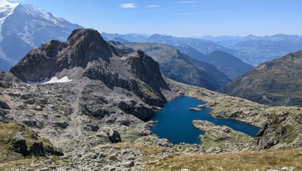
The Aiguilles Rouges reserve offers hikers a wide range of walks in a majestic setting facing the Mont-Blanc massif. Lac Cornu and the Lacs Noirs, classified as ‘’intermediate‘’, remain one of the wonders on offer to the bewildered observer. The route, which requires little effort, includes some steep sections and névés without risk. However, there are no aerial or vertiginous passages on these well-marked paths.
The route starts at the top of the Planpraz cable car, which eliminates much of the climb. However, the latter can be climbed by a path that brings no pleasure whatsoever.
I promise you unforgettable memories in these sublime landscapes, where your eyes are constantly drawn to the most prestigious peaks within easy reach, and to the glaciers where, alas, we can only observe the effects of accelerating global warming.
- Difficulty: Intermediate
- Altitude: 2,276 m at the Lac Cornu, 2,540 m at the Lacs Noirs
- Ascent: 1 hour 45 min to get to the Lac Cornu, 2 hours 30 min to get to the Lacs Noirs
- Descent: 1 hour 30 min from the Lacs Noirs
- Elevation Gain: 790 meters
- Round-trip: 11.0 km
- Map: IGN 3630 OT
- Restrictions : Dogs (even on a leash) and gathering prohibited. Bivouac allowed between 7 p.m. and 9 a.m.
Getting There
In Chamonix, head towards the Brévent cable car car park. Take a return ticket for the Planpraz intermediate station.
Fares and Timetables of the Flégère and Brévent’s cable cars.
GPS Coordinates (WGS 84) of the Starting Point: 45.935837, 6.853083
Ascent
When you leave the cable car, turn left onto the track that rises to the top of the Parsa chairlift. At the path junction, follow the signs for La Flégère for a few metres, then turn left onto a path signposted ‘Lac Cornu’ which, after a few steps, remains gently sloping until you cross a scree slope.
After crossing a large combe below the Aiguille de Charlanon, the path reaches a small gap in large boulders. After a few twists and turns in a combe that still has some snow, you reach the Col Cornu (2,414 m), marked by a huge cairn and a sign for the Aiguilles Rouges reserve.
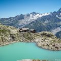
Following the grey markings on the rocks, the route leads to the shores of Lac Cornu over boulders. There are still several snowfalls late in the season.
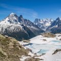
To reach the Lacs Noirs, return to the Col Cornu and follow the yellow route on the right above Lac Cornu. After crossing a number of boulders and some late season névés, the path leads horizontally to the Col de la Glière (2,461 m).
Continue to follow the yellow markings. The final section of the path leads to the magnificent Lacs Noirs, some of which are still covered in snow and ice at the start of the season.
Descent
Take the same route as depicted above.
Photos of the Lac Cornu and the Lacs Noirs
Route
Download the route (KML) Download the route (GPX)
This post is also available in Français


is it safe to walk the trail to Lac Noirs with 8 year old kids who are not used to hiking? Is it a safe trail path? Does it have parts where climbing is required or walking near the edge of the cliff? We intend to walk the trail in good weather in September. Thank you!