Pointe et Lac de Tardevant
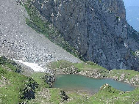
The Aravis Range is made up of a succession of combes delimited by calcareous peaks. The combe of Tardevant is situated in the middle and is the only one to have a lake, which makes it a perfect hiking destination.
The itinerary runs along the slopes of the Grand Crêt, following the beginning of the combe of Paccaly before entering the grassy slopes of the combe of Tardevant.
The ascent to the lake, although sustained, shows no particular difficulty.
The continuation of the route towards Pointe de Tardevant is difficult; The passage of some stones and especially the final ascent can be tricky for people afraid of heights.
The trail is very exposed but perfectly traced and relatively wide.
If you’re afraid of heights, you can stop at the Ambrevetta where the panorama on the Mont Blanc and the valley of Sallanches is striking.
- Difficulty: Hard
- Altitude: 2,110 m at the lake, 2,501 m at the Pointe de Tardevant
- Ascent: 2 hours 30 min to get to the lake + 1 h 10 to get to the Pointe de Tardevant
- Descent: 2 hours 00 min from the Pointe de Tardevant
- Elevation Gain: 1,130 meters
- Round-trip: 12.1 km
- Map: IGN 3430 ET
Getting There
At the entrance of the Clusaz, take straight on the roundabout in the direction of the Vallée des Confins. Follow the road to the terminus. Park in the parking lot at Les Chalets des Confins.
GPS Coordinates (WGS 84) of the Starting Point: 45.923285, 6.483629
Ascent
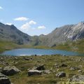
From the car park, take the stony road that leads to Paccaly. After passing the Chalet de la Bottière, continue to the Chalet of Pacaly d’en Bas. Take the track right before this chalet in the direction of Paccaly and the Lac de Tardevant. The pathway is steeper until the chalet of Paccaly d’en Haut that you leave on the right. Proceed towards Tardevant. After passing the chalets of the same name, you reach a succession of grassy dell before getting to a valley where nestles the Lac de Tardevant.
The footway for the Pointe de Tardevant is signposted “Ambrevetta” and goes to the left when you arrive at the lake. The route becomes steeper and engages in a small scree that has to be followed. Continue the trail to its highest point. The view over the Crête des Bénés, La Miaz, and the Mont Blanc is striking and makes you forget all the efforts.
Take the path to the left that runs along the ridges towards the Pointe de Tardevant.
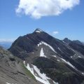
The final ascent is more delicate, but not dangerous: the footpath is exposed and dominates the combe of La Grande Forclaz where a late névé persists. Proceed on this exposed path and well traced up to the top materialized by a cairn.
The panorama is magnificent 360 ° on all the Aravis Range where you discover the passage of the Trou de la Mouche, Pointe Percée, the Mont Blanc Massif, as well as the Bornes Massif with the Jallouvre and Pointe Blanche.
Descent
Take the same road as described above. The view of Mont Blanc with the Ambrevetta in the foreground is beautiful.
A stop at the goat farm at the Confins car park will allow children to caress the goats. Cheeses and regional products are also available for sale.
Photos of Pointe et Lac de Tardevant
Route
Download the route (KML) Download the route (GPX)
This post is also available in Français


