Lac de la Persévérance
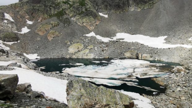
Nestled at the foot of the Aiguilles Rouges, the Lac de la Persévérance is a curiosity that will leave beautiful memories for the hiker. Less frequented than the popular Lac Blanc below, the Lac de la Persévérance is nonetheless a choice destination thanks to the setting it offers.
The itinerary follows the one for the Lac Blanc via the Col des Montets and then follows a stony and somewhat steep path to reach the Lac de la Persévérance.
- Difficulty: Hard
- Altitude: 2,466 m
- Ascent: 3 hours 25 min
- Descent: 2 hours 20 min
- Elevation Gain: 1,245 meters
- Round-trip: 12.6 km
- Map: IGN 3531 OT
Getting There
Join Chamonix, then follow the direction of Argentière. After passing Argentière, continue on the N506 road to park at the Col des Montets.
GPS Coordinates (WGS 84) of the Starting Point: 46.003797, 6.923705
Ascent
Follow the route described for the ascent to Lac Blanc from the Col des Montets. Once you arrive at Lac Blanc, go towards “Lac de la Persévérance – 0 h 40” as indicated by the sign. The path goes along the Lac Blanc on the right and rises quickly. You then reach a nice viewpoint over the entire Lac Blanc. Continue further on the steeper, rocky path. Then you cross a small scree that leads to a late nevé (present on 18 August 2021). This must be crossed carefully, taking care to anchor the heels so as not to slip. After a short ascent, we arrive at the Lac de la Persévérance at the foot of the Aiguilles Rouges.
Descent
The descent is made by the same route. Note that after the upper Lac des Chéserys, it is possible to turn left onto an unmarked path that leads to the lower Lacs des Chéserys.
Photos of Lac de la Persévérance
Route
Download the route (KML) Download the route (GPX)
This post is also available in Français


