Becca Pouegnenta via Lago d’Arpy and Lago di Pietra Rossa
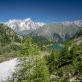
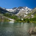
Becca Pouegnenta, nestling in the heart of the Aosta Valley, is a must-see hiking destination for nature lovers and mountain enthusiasts. Although relatively unknown, this summit offers a unique experience, combining wild beauty and absolute tranquillity. Reaching an altitude of 2,827 metres, Becca Pouegnenta overlooks the Lago di Pietra Rossa and offers breathtaking views of the surrounding peaks, including Mont Blanc, the Grandes Jorasses and Mont Fort in the Valais Alps.
The first part of the route is the same as the one described for Lago d’Arpy and Lago di Pietra Rossa. It takes about an hour to climb from Lago di Pietra Rossa to Becca Pouegnenta. This hike is classed as difficult due to the length of the route and the fairly sustained effort required, particularly to climb to the Col d’Ameran before the summit.
- Difficulty: Hard
- Altitude: 2,827 m
- Ascent: 4 hours 00 min
- Descent: 2 hours 25 min
- Elevation Gain: 880 meters
- Round-trip: 16.4 km
- Map: IGC n° 107 Monte-Bianco – Courmayeur
Getting There
Reach Courmayeur, then continue on to Morgex. At the first roundabout, turn right towards Col San Carlo. Follow the road to the pass and park in the car park opposite the Hotel Genzianella.
GPS Coordinates (WGS 84) of the Starting Point: 45.742817, 6.989551
Ascent
First follow the itinerary to reach the Lago di Pietra Rossa (also shared with the Lago d’Arpy at the start).
Once at the Lago di Pietra Rossa, follow the signpost to “Becca Pouegnenta – 1 h 20 – number 19”.
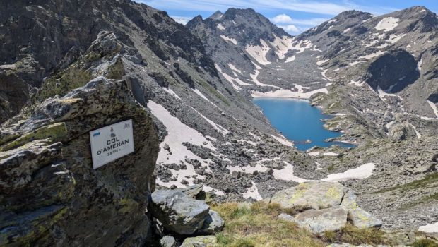
Then walk alongside the lake and take the path leading to the Col d’Ameran, which is clearly visible. You then have to cross several névés, which are not very difficult. The climb then becomes much steeper until you reach the col d’Ameran.
From here, continue to the left towards “Becca Pouegnenta – 0 h 19 min”. The path is steeper and climbs the slope; take care at this short point, which can be tricky. Further on, the finish is very close and is still clearly visible thanks to the cross that marks it.
Descent
Follow the same route as described above.
Photos of Becca Pouegnenta via Lago d’Arpy and Lago di Pietra Rossa
")
")
")
")
")
")
")
")
")
")
")
")
")
")
")
")
")
")
")
")
")
")
")
")
")
")
")
")
")
")
")
")
")
")
")
Route
Download the route (KML) Download the route (GPX)
This post is also available in Français
About the Author
Pierre-Alexandre 32 ans, fondateur et webmaster de Randos-MontBlanc. Suivez-moi sur @pierrealexphotography