Intermediate hikes (350 to 850 m of elevation gain, 2 to 3 hours of walking, 5 to 10 km round-trip) in Haute-Savoie, Switzerland and Italy.

Browsing the "Intermediate" Category
Pointe de Talamarche
12 September 2020 | by Pierre-Alexandre
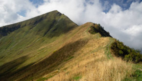
Pointe de Talamarche is a summit of the massif des Bornes culminating at an altitude of 1852m. Much less well known than the popular Tournette, Pointe de Talamarche is nevertheless a great idea
The Moléson
22 June 2020 | by Pierre-Alexandre
The Moléson is an emblematic mountain of the Fribourg Pre-Alps offering a prime hiking destination. Culminating at an altitude of 2002 m, the Moléson is very recognizable by its shape
Mont Clocher
1 June 2020 | by Pierre-Alexandre
Mont Clocher is a summit of the Beaufortain Massif culminating at an altitude of 1976m. Located in the commune of Hauteluce, Mont Clocher is the object of a hike for the greatest number. Indeed, the route is devoid of difficulties and it offers a very wide panorama of the peaks of Savoie and Haute-Savoie
Lac Vert and Lac de Chésery via Portes du Soleil
22 May 2020 | by Pierre-Alexandre
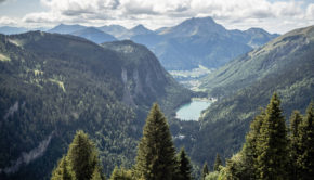
Lac Vert and Lac de Chésery are two relatively unknown lakes in the Chablais massif. Nestled under Pointe des Mossettes and Pointe de Chésery, Lac Vert and Lac de Chésery constitute a charming hiking objective nevertheless. The hike I propose
Aiguillette des Posettes
16 October 2019 | by Pierre-Alexandre
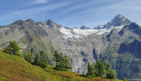
Aiguillette des Posettes is a classic of the Mont-Blanc Massif. Located at the eastern end of the Chamonix valley, Aiguillette des Posettes is a choice hike that will delight both young and old. The panorama served at the top is one of the most extensive in the massif
Mont d’Or (from Vallorbe)
1 June 2019 | by Pierre-Alexandre
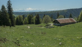
Highest point in the Doubs department, Mont d’Or is a peak of the Jura Massif. Located a few miles from the Franco-Swiss border, Mont d’Or naturally stands out as the perfect location for a beautiful family hike with its panoramic view of the Lake Geneva Basin, the Alps and the nearby mountains
Creux-du-Van
7 May 2019 | by Pierre-Alexandre
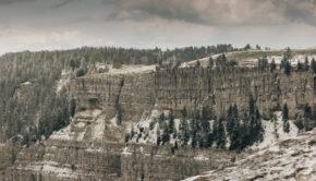
The Creux-du-Van is a rocky cirque located in the Massif du Jura in the canton of Neuchâtel. 1.4 km wide and approximately 200 m high, the Creux-du-Van is one of the most picturesque sites in French-speaking Switzerland with its impressive walls sculpted by the erosion caused 18,000 years ago
Praz Vechin and Col de l’Arpettaz
7 January 2019 | by Pierre-Alexandre
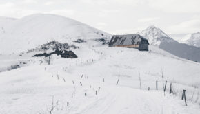
Located in the Aravis Range, Praz Vechin is a peak overlooking the Col de l'Arpettaz nestled at the foot of Mont Charvin. The term "Arpettaz" comes from the French word "alpe" which refers to a mountain pasture. The itinerary I propose here starts from the hamlet of La Penne
Tête de Lindaret
10 October 2018 | by Pierre-Alexandre
Tête de Lindaret is a summit of the Chablais Massif, located in the south of the protected natural area of Mont de Grange. The toponym Lindaret limitaris meaning something "that makes limits or borders". Of intermediate difficulty, the itinerary I propose here describes a loop that starts from the Lindarets
Pointe de Pelluaz
25 September 2018 | by Pierre-Alexandre
Pointe de Pelluaz is a peak located in the heart of the Chablais massif, south of the Dent d'Oche. Described as peeled or bare mountain by its toponym, Pointe de Pelluaz is a beautiful hiking destination within everyone's reach. Indeed, despite a cumulative positive gain of 730 m,
Boka Waterfall (Slap Boka)
9 September 2018 | by Pierre-Alexandre
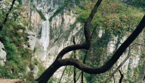
The Boka Waterfall (or Slap Boka in Slovenian), with its 139 metres, is the highest waterfall in Slovenia and is located upstream from the river Soča (also called Isonzo). The waterfall begins at a karst spring and has two levels: a first stage 106 metres high and 18 metres wide, as well as a
Aletsch Glacier
5 September 2018 | by Pierre-Alexandre
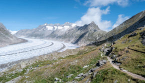
Located in the south of Switzerland, in the canton of Valais, the Aletsch glacier is the largest glacier in the Alps. Inscribed on the UNESCO World Heritage List in 2001, the Aletsch glacier will not leave the hiker indifferent in view of its characteristics : 81.7 km2 of surface, 22.6 km in length, 900 m in
